These pages provide access to a range of spatial and environmental/ecological data derived from various sources including GPS and GIS mapping, historic aerial photographs, satelite images, botany geoarchaeology, and physical geography. Much of this data focuses on Marakwet agricultural land and water management.
-
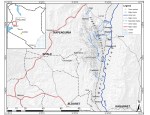
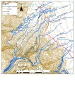
- Marakwet Location
-

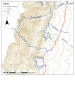
- Marakwet Irrigation
-

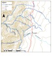
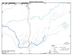
- Arror irrigation
-
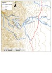
- Chesoi irrigation
-
- Chestetan-Embamon irrigation
-
- Chesongoch-Enou
-

- Kabetwa-Embolot irrigation
-

- Lower Embobut-Tot irrigation
-
- Upper Embobut and Chesegon irrigation
-

- Points of interest along Kamariny irrigation furrow
-
- Kapshoi irigation network Tot-Sibou
-

- Kapshoi furrow and fields
-
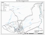
- Tot-Sibou Clan, fields and irrigation
-

- Marakwet irrigation furrows schematic

Marakwet Heritage Project Archives by Marakwet Heritage Project is licensed under a Creative Commons Attribution-NonCommercial-NoDerivatives 4.0 International License.
Based on a work at www.marakwetheritage.com.
